rareoldprints.com


Search

If you know the reference number
enter it here:


If you enter more than one word
it will be treated as phrase.

Insert "and" or "or" between words to search for the words in any order.

Refine your search here or build another search.
Displaying 0 to 5 of 5 - -
89%
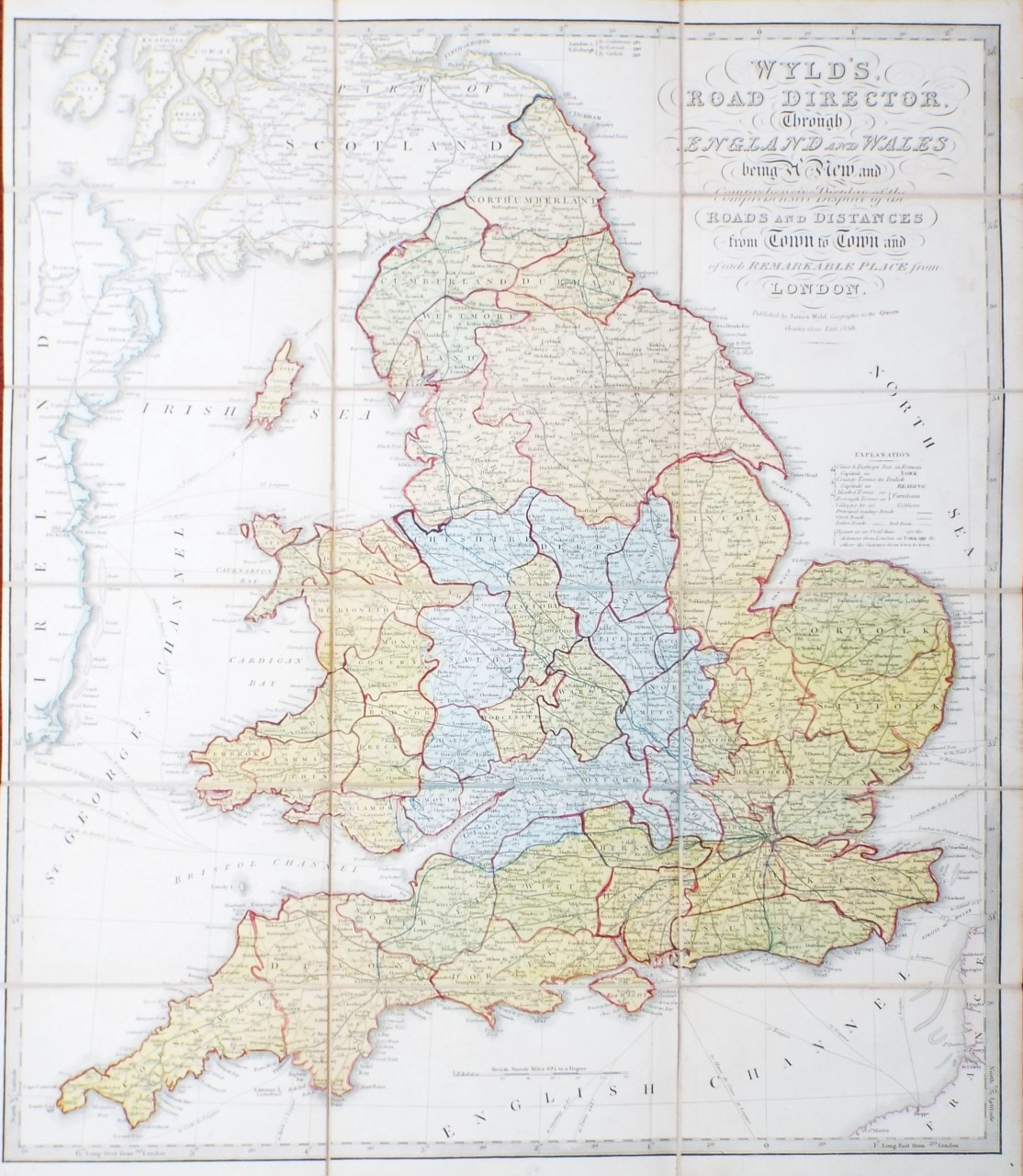
Wyld's Road Director, Through England and Wales being a New and Comprehensive Display of the Roads and Distances from Town to Town and of each Remarkable Place from London.
Ref: P/30755
Region: British Isles
Type: Copper
Publisher: James Wyld
Date: 1838

88%
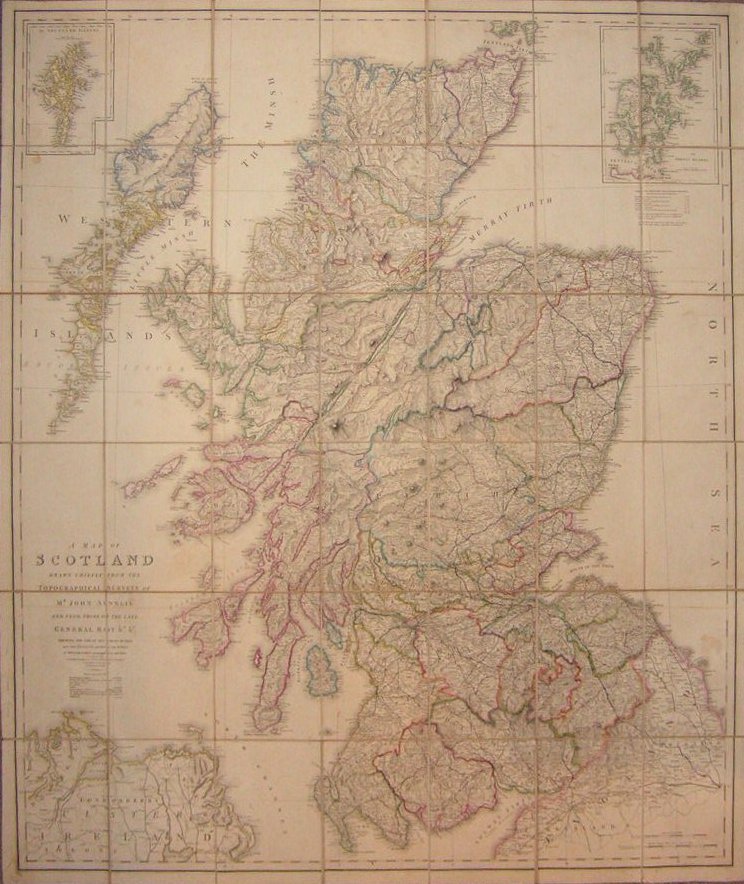
A Map of Scotland Drawn Chiefly from the Topographical Surveys of Mr John Ainslie and from those of the late General Roy &c &c Shewing the Great and Cross Roads, and the Distances between the Towns, by William Faden, Geographer to the King.
Ref: P/5036
Region: Scotland
Type: Copper
Cartographer: Ainslie J
Publisher: Js Wyld

87%
Wylde's New Plan of London and its Vicinity.
Ref: P/18043
Region: London
Type: Lithograph
Publisher: James Wyld, Geographer to the Queen, 457 Strand
Date: 1872

87%
Holland & Belgium formerly Kingdom of the Netherlands
Ref: P/10712
Region: Netherlands
Type: Copper
Cartographer: J W
Engraver: Stockley
Publisher: James Wyld

86%
Map of the River Wye and Adjacent Country from Chepstow to Monmouth
Ref: P/3591
Region: River Wye
Type: Copper
Engraver: Wyld Jas
Publisher: Wrightson & Webb, Birmingham

Sold

Displaying 0 to 5 of 5